


Utah County (West)--Saratoga Springs, Payson & Lehi (Southwest) Cities PUMA, Utah
About
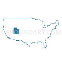
Outline
--Saratoga+Springs%2c+Payson+%26+Lehi+(Southwest)+Cities+PUMA%2c+Utah_A280.png)
Summary
| Unique Area Identifier | 194237 |
| Name | Utah County (West)--Saratoga Springs, Payson & Lehi (Southwest) Cities PUMA |
| State | Utah |
| Area (square miles) | 896.82 |
| Land Area (square miles) | 756.86 |
| Water Area (square miles) | 139.96 |
| % of Land Area | 84.39 |
| % of Water Area | 15.61 |
| Latitude of the Internal Point | 40.15610050 |
| Longtitude of the Internal Point | -111.95286800 |
Maps
--Saratoga+Springs%2c+Payson+%26+Lehi+(Southwest)+Cities+PUMA in Utah.png)
Graphs
Select a template below for downloading or customizing gragh for Utah County (West)--Saratoga Springs, Payson & Lehi (Southwest) Cities PUMA, Utah
--Saratoga+Springs%2c+Payson+%26+Lehi+(Southwest)+Cities+PUMA%2c+Utah_T0.png)
--Saratoga+Springs%2c+Payson+%26+Lehi+(Southwest)+Cities+PUMA%2c+Utah_T1.png)
--Saratoga+Springs%2c+Payson+%26+Lehi+(Southwest)+Cities+PUMA%2c+Utah_T2.png)
--Saratoga+Springs%2c+Payson+%26+Lehi+(Southwest)+Cities+PUMA%2c+Utah_T3.png)
--Saratoga+Springs%2c+Payson+%26+Lehi+(Southwest)+Cities+PUMA%2c+Utah_T4.png)
--Saratoga+Springs%2c+Payson+%26+Lehi+(Southwest)+Cities+PUMA%2c+Utah_T5.png)
--Saratoga+Springs%2c+Payson+%26+Lehi+(Southwest)+Cities+PUMA%2c+Utah_T6.png)
--Saratoga+Springs%2c+Payson+%26+Lehi+(Southwest)+Cities+PUMA%2c+Utah_T7.png)
--Saratoga+Springs%2c+Payson+%26+Lehi+(Southwest)+Cities+PUMA%2c+Utah.png)
Neighbors
Neighoring Public Use Microdata Area (by Name) Neighboring Public Use Microdata Area on the Map
- Salt Lake County (South & East Central)--Draper (Northwest) & Sandy (South) Cities PUMA, UT
- Salt Lake County--West Jordan (East), South Jordan (East) & Riverton Cities PUMA, UT
- Salt Lake County--West Jordan (West), Herriman & South Jordan (West) Cities PUMA, UT
- Southwest & South Central Utah (Outside Washington County)--Cedar City PUMA, UT
- Tooele & Box Elder Counties PUMA, UT
- Utah County (Central)--Orem, Pleasant Grove, American Fork & Lindon Cities PUMA, UT
- Utah County (Central)--Provo City PUMA, UT
- Utah County (East)--Spanish Fork, Springville, Lehi (Northeast) & Highland Cities PUMA, UT
Top 10 Neighboring County (by Population) Neighboring County on the Map
- Salt Lake County, UT (1,029,655)
- Utah County, UT (516,564)
- Tooele County, UT (58,218)
- Juab County, UT (10,246)
Top 10 Neighboring County Subdivision (by Population) Neighboring County Subdivision on the Map
- Salt Lake City CCD, Salt Lake County, UT (932,320)
- Provo-Orem CCD, Utah County, UT (200,995)
- American Fork-Pleasant Grove CCD, Utah County, UT (121,452)
- Lehi CCD, Utah County, UT (74,616)
- Spanish Fork-Payson CCD, Utah County, UT (73,527)
- Bingham CCD, Salt Lake County, UT (55,288)
- Tooele-Grantsville CCD, Tooele County, UT (54,800)
- Springville-Mapleton CCD, Utah County, UT (42,473)
- Nephi CCD, Juab County, UT (9,366)
- Goshen CCD, Utah County, UT (3,501)
Top 10 Neighboring Place (by Population) Neighboring Place on the Map
- Provo city, UT (112,488)
- Lehi city, UT (47,407)
- Draper city, UT (42,274)
- Spanish Fork city, UT (34,691)
- Springville city, UT (29,466)
- American Fork city, UT (26,263)
- Herriman city, UT (21,785)
- Eagle Mountain city, UT (21,415)
- Payson city, UT (18,294)
- Saratoga Springs city, UT (17,781)
Top 10 Neighboring Unified School District (by Population) Neighboring Unified School District on the Map
- Alpine School District, UT (284,505)
- Jordan School District, UT (218,793)
- Canyons School District, UT (204,224)
- Nebo School District, UT (119,571)
- Provo School District, UT (112,488)
- Tooele School District, UT (58,218)
- Juab School District, UT (9,367)
- Tintic School District, UT (879)
Top 10 Neighboring State Legislative District Lower Chamber (by Population) Neighboring State Legislative District Lower Chamber on the Map
- State House District 56, UT (90,503)
- State House District 52, UT (61,341)
- State House District 27, UT (49,237)
- State House District 65, UT (49,224)
- State House District 21, UT (44,298)
- State House District 57, UT (43,966)
- State House District 67, UT (42,669)
- State House District 51, UT (41,517)
- State House District 66, UT (37,524)
- State House District 41, UT (36,962)
Top 10 Neighboring State Legislative District Upper Chamber (by Population) Neighboring State Legislative District Upper Chamber on the Map
- State Senate District 13, UT (150,707)
- State Senate District 11, UT (137,882)
- State Senate District 10, UT (122,731)
- State Senate District 14, UT (98,499)
- State Senate District 27, UT (93,972)
- State Senate District 24, UT (85,639)
- State Senate District 15, UT (84,373)
Top 10 Neighboring 111th Congressional District (by Population) Neighboring 111th Congressional District on the Map
- Congressional District 3, UT (966,232)
- Congressional District 1, UT (906,660)
- Congressional District 2, UT (890,993)
Top 10 Neighboring Census Tract (by Population) Neighboring Census Tract on the Map
- Census Tract 1151.06, Salt Lake County, UT (7,858)
- Census Tract 101.05, Utah County, UT (7,564)
- Census Tract 1128.20, Salt Lake County, UT (7,344)
- Census Tract 1128.10, Salt Lake County, UT (7,066)
- Census Tract 101.04, Utah County, UT (6,999)
- Census Tract 1307.03, Tooele County, UT (6,997)
- Census Tract 101.09, Utah County, UT (6,936)
- Census Tract 101.11, Utah County, UT (6,815)
- Census Tract 101.03, Utah County, UT (6,738)
- Census Tract 103.04, Utah County, UT (6,590)
Top 10 Neighboring 5-Digit ZIP Code Tabulation Area (by Population) Neighboring 5-Digit ZIP Code Tabulation Area on the Map
- 84043, UT (49,030)
- 84074, UT (44,310)
- 84003, UT (42,384)
- 84020, UT (39,765)
- 84065, UT (38,168)
- 84660, UT (37,995)
- 84096, UT (33,396)
- 84601, UT (31,486)
- 84058, UT (30,540)
- 84663, UT (29,975)